
Monday Light Icing Possible

Keeping an eye on the potential for light icing Monday afternoon and evening.

Saturday PM Update:

The going forecast from the previous update still looks pretty accurate. I took a screenshot of the projected freezing rain totals expected according to the computer model which lines up well with what we have been seeing for a couple of days. There has been a little more of Western Kentucky included in the chance of the light icing but other than that, see below for other graphics.

12Z SAT NAM MODEL RUN - FROM EARL BARKER SNOW

Friday PM Update:

For a few days now, computer models have been indicating that cold air will spill into the northern half of the Local 6 area Monday throughout the day before moisture leaves the area. Temperatures will begin in the 40's during the morning then drop to near freezing by mid to late afternoon. Areas in Western Kentucky along the Ohio River north into Southern Illinois and most of Southeast Missouri will most likely see the arrival of this cold air before all of the moisture moves east.

Main impacts will be on elevated surfaces such as trees, windshields, overpasses, and bridges across the area. Ice accumulation appears to be light at .05-.10 in the identified area below.

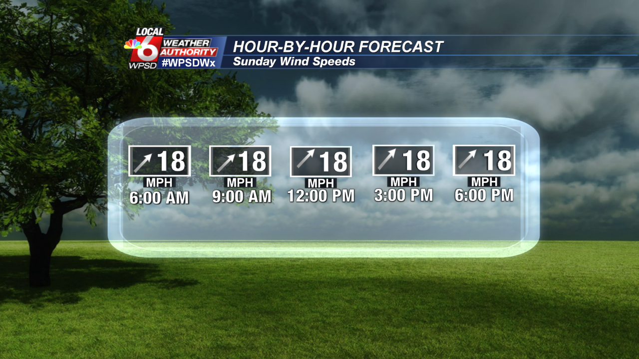
Winds will be a big part of the weather story all weekend long as this cold front approaches and temperatures warm quickly. Winds will ramp up Saturday from the SSW from 10-20 mph and stay elevated into Sunday and Monday until the front passes. Here is a look at the winds hour-by-hour for both Saturday and Sunday. Wind gusts may reach between 25-30mph.

Comments

Popular posts from this blog

Planting Zones Heading North

As our global climate changes, so does our planting zones, helping us determine which flowers/shrubs/trees are hardy in specific areas. The Local 6 area has always been split by 2-3 growing zones so placement becomes very important to those in the agricultural community. The image below represents the average over the past 30 years. Climate Central published the following information:  "What kinds of flowers, shrubs and trees you’ll find at your local nursery depends on your climate — how warm it tends to get in summer, and how cold in winter. A plant that’s happy in Wisconsin might be miserable in Alabama, and vice versa. The U.S. Department of Agriculture has formalized these differences into " hardiness zones " — strips of similar climate that run more or less east-to-west (except in the high mountains), where particular plants should do especially well. But as the planet warms under its thickening blanket of greenhouse gases, those zones are shifting northward. Th...

Longer Allergy Seasons

The National Phenology Network is showing the early arrival of leaves on trees in the Ohio Valley, the Midwest, and Western United States this year. This trend has become more of a norm over the past past 50 years.   Climate Central published data this week showing the same trend since 1970 with notable attention to the West where states are seeing as many as 17 more frost-free days, extending the growing season. Here in the Local 6 area, the growth is not as notable but still averaging between 4-9 days additional to the growing season. Why does this matter? Aside from having an influence on which plants are suitable for planting zones, it has a much higher societal impact by extending the allergy season.  "As the climate warms from the increase of greenhouse gases into the atmosphere, the last spring freeze is trending earlier and the first fall freeze is coming later. This means the growing season is getting longer, and so is the pollen season— whether it i...

Tri-State Tornado Double Take

Credit: Chris Conley, Spotter  A well-forecast severe weather event unfolded Tuesday night starting in Southeast Missouri then blowing east into Southern Illinois, The Paducah National Weather Service along with local media gave people in Perryville, MO the early alarm that a large tornado was barreling their way. Storm spotter Chris Conley captured power flashes (right) from the violent tornado hitting power lines as the storm traveled from Perryville across the Mississippi River into Rockwood, IL after claiming one man's life on Interstate 55 and injuring 12 in Perryville. Credit: John Humphress, Spotter The supercell thunderstorm parent to this tornado was only getting started. Confirmation of a tornado and a trail of damage was reported in Rockwood, Ava, Elkville, Christopher, Buckner, Enfield and Crossfield, IL. Storm spotter John Humphress captured the wedge tornado (left) that struck Crossville where a man was killed trying to take shelter. Humphress recal...