*See live streaming schedule at bottom of post*
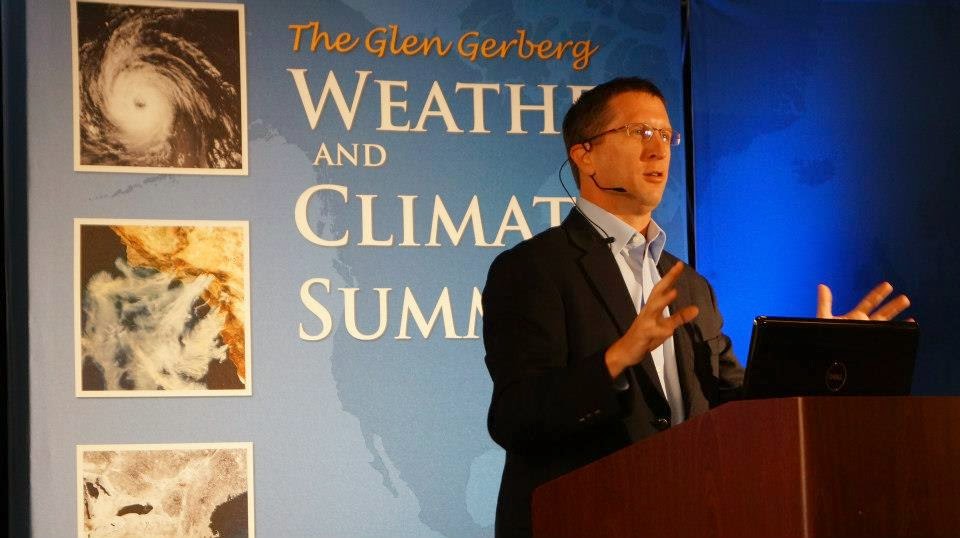
 Join Chief Meteorologist Jennifer Rukavina as she travels to this year's Glen Gerberg Weather and Climate Summit at Breckenridge, Colorado.
Starting Monday January 12th watch for her live reports at 5 and 6 pm on WPSD Local 6. She will be talking with today's leading meteorologists and scientists about the latest technology and forecasting tools plus the status of today's climate.
You can interact with Jennifer in a chat area of the live stream when you take it full if you have questions for her or the speakers/scientists.
Live Streaming Schedule
MONDAY, January 12th
8:00-8:25am Weather Briefing - Dale Eck, Director-Global Forecast Center, The Weather Channel
8:30-10:00am SESSION 1: Dr. Bill Lapenta, Director, NOAA NWS NCEP, Topic: The New National Weather Service - Model Improvements, NCEP Priorities and Building A Weather Ready Nation
10:00-10:15am BREAK
10:15-11:45am SESSION 2: RADM (Ret) Dr. David Titley, Penn State University, Professor of Practice, Department of Meteorology & Director, Center for Solutions to Weather and Climate Risk
11:50-12:15pm LIVE STREAM - Speaker Q&A Session (LaPenta & Titley)
12:15 – 12:45pm Speaker Interview Opportunity with Bill Lapenta and David Titley in Mt. Elbert (must schedule interviews ahead oftime with Ryan Whaley – 10min max/per interview)
TUESDAY, January 13th
7:30-8:00am LIVE Streaming Begins, Columbine A
8:30-10:00am SESSION 3: Dr. Rick Knabb, Director, National Hurricane Center, 2014 Hurricane season & New NHC Products for a Weather Ready Nation
10:00-10:15am BREAK
10:15- 11:45am SESSION 4: Greg Mandt, GOES-R Program Manager, Topic: New GOES-R satellite transformational capabilities to Improve Short-Term Forecasting and Warnings-The New Environmental Intelligence Satellite Series
11:50am-12:15pm LIVE STREAM - Speaker Q&A Session (Knabb & Mandt)
12:15pm LIVE Streaming Ends
12:15 – 12:45pm Speaker Interview Opportunity with Greg Mandt and Rick Knabb in Mt. Elbert (must schedule interviews ahead of time with Ryan Whaley – 10min max/per interview)
WEDNESDAY, January 14th
7:30-8:00am LIVE Streaming Begins, Columbine
8:00-8:30am Weather Briefing, Dale Eck, Director-Global Forecast Center, /The Weather Channel
8:30am-10:00am SESSION 5: James Balog, National Geographic & University of Colorado, Topic: Chasing Ice….Yes, it IS melting!
7:30-8:00am LIVE Streaming Begins, Columbine
8:00-8:30am Weather Briefing, Dale Eck, Director-Global Forecast Center, /The Weather Channel
8:30am-10:00am SESSION 5: James Balog, National Geographic & University of Colorado, Topic: Chasing Ice….Yes, it IS melting!
10:00am-10:15am BREAK
10:15am - 11:45am SESSION 6: Dr. Jim White, University of Colorado, Topic: Arctic Ice Loss, Sea Level Rise and Coastal Impacts
10:15am - 11:45am SESSION 6: Dr. Jim White, University of Colorado, Topic: Arctic Ice Loss, Sea Level Rise and Coastal Impacts
11:45am-12:15pm LIVE STREAM - Speaker Q&A Session (Balog & White)
12:15 – 12:45pm Speaker Interview Opportunity with James Balog and Jim White in Mt. Elbert
12:15 – 12:45pm Speaker Interview Opportunity with James Balog and Jim White in Mt. Elbert
6:00 – 7:00pm Community Town Hall Meeting - DoubleTree Hotel, Breckenridge, CO "The Arctic is Changing Rapidly: How Will Those Changes Impact Us?"
STREAMED LIVE - James Balog & Dr. Jim White
THURSDAY, January 15th
7:30-8:30am LIVE Streaming Begins, Columbine A
8:00-8:30am Weather Briefing, Dale Eck, The Weather Channel
8:30-10:00am SESSION 7: Paul Kocin, NOAA NWS WPC Meteorologist, Topic: Winter Weather Forecasting Workshop
THURSDAY, January 15th
7:30-8:30am LIVE Streaming Begins, Columbine A
8:00-8:30am Weather Briefing, Dale Eck, The Weather Channel
8:30-10:00am SESSION 7: Paul Kocin, NOAA NWS WPC Meteorologist, Topic: Winter Weather Forecasting Workshop
10:00-10:15am BREAK
10:15-11:45am SESSION 8: Dr. Peter Gleick, Pacific Institute Topic: Climate Change, Drought & National Security: Does Water Really Cause War?
11:50-12:15pm LIVE STREAM - Speaker Q&A Session
12:15 – 12:45pm Speaker Interview Opportunity with Kocin and Gleick in Mt. Elbert
View Jennifer Rukavina's story posts on her Facebook Fan Page: http://ift.tt/1BEUS7s
View WPSD's Webchannel for Weather: http://ift.tt/1HW6Xac
Comments
Post a Comment